



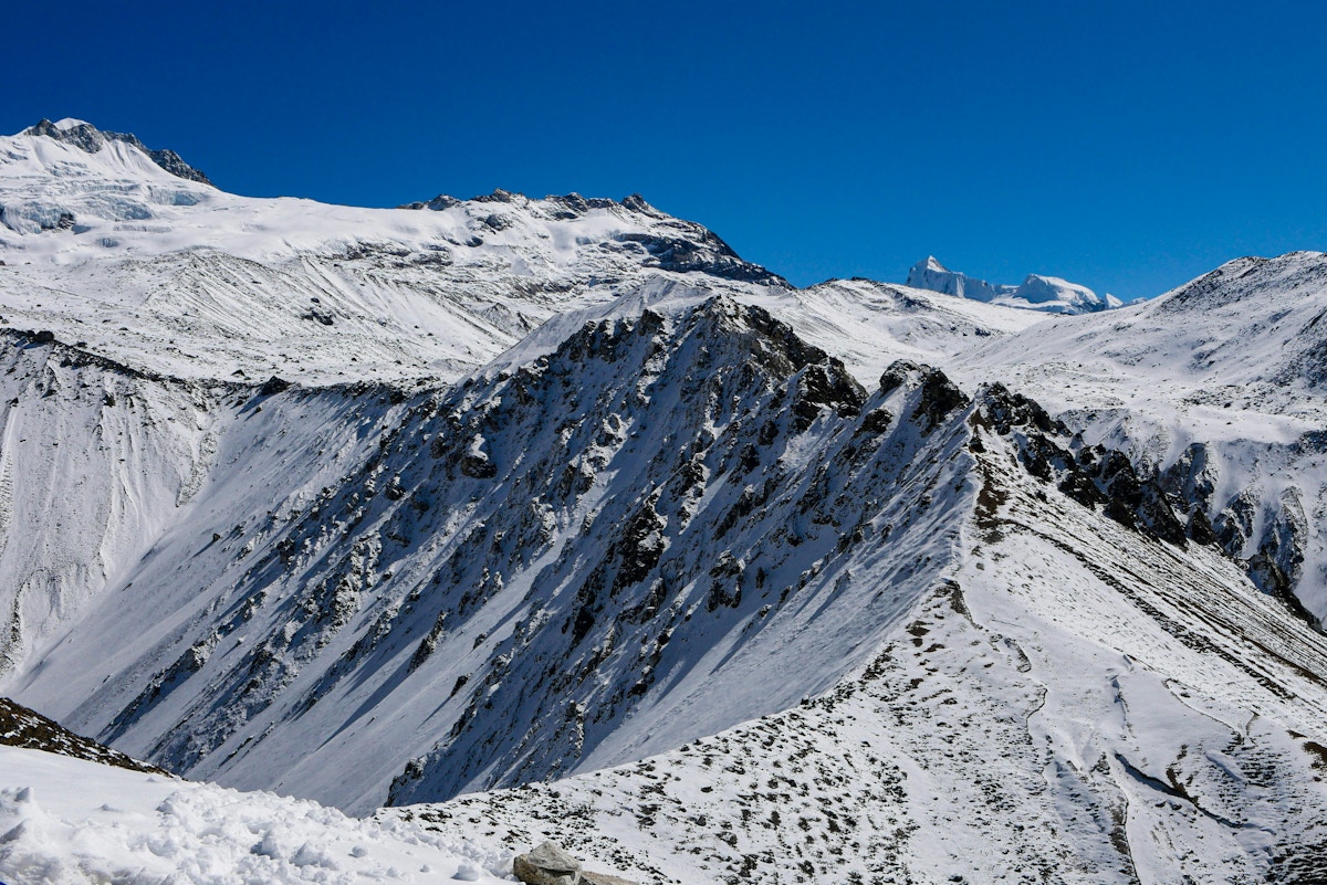
Hundreds of workers are feared trapped inside hydropower tunnels blocked by mud and boulders. More than 90,000 people are estimated to have been affected, while damaged roads and bridges have cut off communities and complicated efforts to recover and identify victims.
The precise cause of the 26 August disaster remains under investigation. Preliminary assessments indicate that a large mass of glacier ice, rock and other material collapsed in Nepal’s Langtang region before gathering water and sediment and forming a fast-moving debris flow that travelled about 100 kilometres downstream.
The World Meteorological Organization (WMO) said the disaster demonstrated how “changes and instabilities in the cryosphere can rapidly translate into destructive downstream impacts across national borders.” The cryosphere comprises the frozen parts of the Earth, including glaciers, snow and permafrost.
The UN scientific agency said rising temperatures were altering glaciers, snow conditions, permafrost and mountain slopes across the Hindu Kush Himalaya, increasing the risks associated with glacier-related floods. It called for better monitoring, more resilient observation networks and faster exchanges of information across borders.
According to the International Centre for Integrated Mountain Development, or ICIMOD, a large volume of ice and rock debris may have entered the Lhende Khola and temporarily blocked the river. The subsequent failure or overflow of that blockage could have released a surge through the Bhote Koshi and Trishuli river system, although the organisation cautioned that the sequence had not been conclusively established.
The chain is an example of what scientists call a cascading hazard, in which an initial failure involving rock and ice develops into an avalanche, river blockage, debris flow and flood, gathering water, sediment and energy as it moves downstream.
Warming mountains
ICIMOD said it was too early to determine what role climate change played in this particular disaster. High mountain slopes can be destabilised by several factors, including geological weaknesses, seismic activity, heavy snow, intense rainfall and the natural movement of glaciers.
Scientists nevertheless warn that global warming is creating conditions that can increase the likelihood and destructive potential of such events. Rising temperatures melt and thin ice that helps support steep rock faces, increase the amount of meltwater entering cracks and alter cycles of freezing and thawing. Thawing permafrost can further weaken the frozen material binding mountain slopes together.
WMO has said glacier-related flood hazards are increasing as a warmer climate accelerates ice melt. As glaciers retreat, new lakes can form and existing ones can expand, while surrounding slopes and natural dams of ice and sediment can become less stable.
Scientists cited by Reuters said warming was unlikely to have been the sole immediate trigger of the Nepal disaster, but that rising temperatures and glacier melt probably contributed to the conditions surrounding it.
“The pace of change is so rapid that current efforts are struggling to keep up,” said Mohd. Farooq Azam, an ICIMOD senior cryosphere specialist.
A 2026 study in Communications Earth & Environment found that ice-rock avalanches were becoming more frequent as Himalayan slopes were destabilised by rapid glacier retreat, extreme precipitation and permafrost degradation. Once initiated, the study said, these avalanches can gather water and sediment and transform into high-velocity debris flows capable of travelling tens of kilometres.
Accelerating glacier loss
The Hindu Kush Himalayan region stretches from Afghanistan to Myanmar and contains the world’s largest volume of ice outside the polar regions. Its snow and glaciers feed river systems on which nearly two billion people depend directly or indirectly for water, food and energy.
An ICIMOD assessment published in 2023 found that the region’s glaciers disappeared 65 per cent faster between 2011 and 2020 than during the previous decade.
Under current emissions trajectories, the region could lose as much as 80 per cent of its present glacier volume by the end of the century, the assessment said. The loss would initially increase meltwater and some flood hazards before eventually reducing the long-term water supply to major Asian rivers.
The effects of warming are not limited to shrinking glaciers. Higher temperatures can create or expand lakes as glaciers retreat, destabilise moraine dams composed of loose sediment and expose previously frozen slopes. Avalanches and landslides falling into glacial lakes can displace large quantities of water and trigger sudden downstream floods.
The WMO said the Rasuwa disaster demonstrated how instability in the cryosphere – the frozen part of the Earth’s surface – could rapidly produce destructive effects across borders.
The agency said more than 25,000 glacial lakes had been identified across five major river basins in the Hindu Kush Himalaya. It called for sustained monitoring, resilient observation networks and faster exchanges of satellite, meteorological and river data between neighbouring countries.
Hydropower exposure
The Nepal flood also highlighted a tension at the center of the region’s energy transition. Hydropower can help countries reduce their dependence on coal and imported fossil fuels, but many projects are being constructed in narrow valleys below glaciers and unstable mountain slopes.
The flood knocked more than 430 megawatts of generating capacity offline, equivalent to over 10 per cent of Nepal’s power capacity, according to an assessment by the Washington-based Stimson Center. It also damaged 19 bridges and roughly 40 kilometers of highway.
Rescue efforts have focused on hundreds of workers believed to be trapped in tunnels and underground sections of hydropower projects in Rasuwa and Nuwakot districts. Nepal’s disaster authority said 933 people associated with hydropower projects were among those missing.
Deep deposits of mud, boulders and other debris have obstructed tunnel entrances, forcing rescuers to use excavators and heavy equipment to reach potential survivors. Nearly 21,000 security personnel, civilian workers and volunteers have been mobilized, with India and China also providing experts and equipment.
Among the facilities hit was the 216-MW Upper Trishuli-1 project, a US$647 million development led by Korea South-East Power and Doosan Enerbility. More than 90 per cent of its upper cofferdam section was washed away, according to Korean company officials.
The plant was about 84 per cent complete and had been scheduled to finish by the end of 2026, with commercial generation expected in July 2027. It was designed to generate about 1,456 gigawatt-hours of electricity annually.
A similar ice-rock avalanche in India’s Himalayan state of Uttarakhand in 2021 killed more than 200 people and severely damaged two hydropower projects. Scientists have cited that disaster as evidence that infrastructure assessments must consider cascading hazards extending beyond conventional rainfall floods and glacial-lake outbursts.
Warning gaps
Nepal’s disaster has renewed scrutiny of monitoring and warning systems across the border with China.
Nepali officials asked China for more information about glacier movement and river levels during bilateral talks in Kathmandu in May. They later said the information exchanged focused largely on rainfall forecasts and did not regularly cover avalanches, glacier movement or abrupt changes in water levels.
China’s embassy said the countries had made substantial progress on disaster-information sharing and that Chinese authorities had supplied important information in a timely manner. Nepali officials and independent experts said there was no evidence that gaps in bilateral cooperation significantly affected the response to this disaster.
The speed of the flood nevertheless demonstrated how narrow the window for action can be. Water levels on the Trishuli River at Galchhi rose by as much as nine metres in 30 minutes, while levels at Malekhu increased by seven metres over a similar period, according to ICIMOD. Several monitoring stations were damaged or swept away.
Basanta Raj Adhikari, director of Tribhuvan University’s Centre for Disaster Studies, said the flood reflected a broader transformation in the threats facing Himalayan communities.
“Multi-hazard risks are increasing in the Himalayas and the Lhende Khola case is one such example,” he said, cited by ICIMOD. “The exposure and risk profile of downstream communities including Rasuwa and Betrawati is changing dramatically.”
Collecting and sharing data was therefore only one part of an effective warning system, Adhikari said. Information must also reach the authorities and communities able to act before an emerging mountain hazard moves downstream.
“With these communities at the forefront, real time risk information needs to reach local decision-makers and translate into life-saving decisions.”